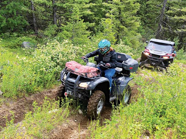
There are 6 Jeep trails in the Colville National Forest that are open to motorized and non-motorized recreation, and one of the more popular and accessible trails is Owl Mountain, located just west of Orient, Washington. This Jeep trail is popular with OHV users, as longer wheelbase vehicles can have problems with the obstacles and deadfall on the trail, making this trail idea for high-clearance, short wheelbase ATVs and side-by-side vehicles! The trail is also wide enough to make hiking and horseback riding easy, and the remote location means there’s seldom vehicle traffic on the trail, making this an ideal location for a quiet ride or hike in the forest!
Getting to the Owl Mountain Jeep trail is easy: From Kettle Falls, go west on Hwy 395, across the Columbia River Bridge, turning right on Hwy 395. Proceed north to Orient, approximately 18.5 miles, continue past Orient on Hwy 395 another 1.6 miles, then turn left on Eslick Road. Then, continue on another 1.25 miles to the intersection with Little Boulder Creek Rd by staying to the left at the fork in the road. It is another 2.6 miles to the intersection with Rd # 160 on the right, and this “Y” intersection is the staging/parking area for Owl Mountain Jeep trail.
It’s recommended that you drive Owl Mountain Jeep trail from the west trailhead if it’s your first time on the trail, as it’s much easier to descend the steep slopes on the east end of the trail. For the western trailhead, proceed 1 mile up the #160 road from the staging area. Stay to the left on #160; Kerry Creek Road (Rd #150) is on the right. Proceed straight ahead another 1 mile, and watch for a small trail forking right off the main road into the trees – you’ll see a pair of trees that have grown into a v-formation at this intersection. The trailhead is currently not marked. Use your Colville National Forest Motor Vehicle Use Map (MVUM) or the Avenza mapping app to ensure you’re on the trail – Avenza is a free download from your app store that makes your phone or tablet into a GPS, which is invaluable for riding our NE Washington Jeep trails, since none of them are well-marked or signed! At the east end of the trail, you’ll find a dispersed campsite with large fire ring – turn right onto USFS Road #220 and proceed 0.9 miles. Turn right onto USFS Road #215 and proceed 0.7 miles, then turn right onto USFS Road #150 (Kerry Creek Road). Stay on this main road for 5.15 miles, then turn left onto USFS Road #160 and proceed 1 mile to the staging area.
This trail is rated as a moderately difficult Jeep trail for experienced drivers. There are rocky pitches to climb and descend through, steep slopes, lots of muddy areas due to seeps and drainage, a small swampy crossing, a rocky pinch point with a large center boulder that makes it difficult for low-clearance vehicles, and lots of brush and deadfall throughout the trail. Most obstacles do not have bypasses – low clearance, longer wheelbase, and smaller rigs should use extra caution on this trail. All vehicles should carry saws in case deadfall is blocking the trail – the USFS does not maintain this trail, although Tri-County Motorized Recreation Association (TCMRA) clears the trail at least several times a year. The Owl Mountain Jeep Trail #102 is 7.18 miles long, trailhead to trailhead. Allow 3-4 hours for the trip on the trail – there are several great viewpoints for lunch breaks!
If you recreate on the trail in Northeast Washington, NEWSTART would love to know what you think needs to be considered in the Trail Strategy.
Please take the comprehensive, 20-minute survey by visiting the website below. We appreciate and value your input!
